- 2021
- December (1)
- March (87)
- February (60)
- January (35)
- 2020
- December (109)
- November (111)
- October (109)
- September (114)
- August (22)
- July (129)
- June (116)
- May (93)
- April (106)
- March (114)
- February (53)
- January (31)
- 2019
- December (37)
- November (72)
- October (52)
- September (43)
- August (65)
- July (55)
- June (14)
- May (55)
- April (72)
- March (28)
- February (1)
- January (12)
- 2018
- December (49)
- November (45)
- October (44)
- September (31)
- August (61)
- July (46)
- June (48)
- May (33)
- April (61)
- March (53)
- February (45)
- January (50)
- 2017
- December (46)
- November (56)
- October (60)
- September (20)
- August (56)
- July (61)
- June (58)
- May (28)
- April (44)
- March (57)
- February (54)
- January (42)
- 2016
- December (55)
- November (70)
- October (73)
- September (24)
- August (50)
- July (47)
- June (61)
- May (19)
- April (48)
- March (47)
- February (33)
- January (45)
- 2015
- December (43)
- November (39)
- October (53)
- September (55)
- August (19)
- July (47)
- June (28)
- May (26)
- April (54)
- March (55)
- February (29)
- January (30)
- 2014
- December (26)
- November (48)
- October (44)
- September (30)
- August (28)
- July (30)
- June (23)
- May (53)
- April (30)
- March (25)
- February (31)
- January (16)
- 2013
- December (23)
- November (29)
- October (34)
- September (12)
- August (15)
- July (23)
- June (12)
- May (24)
- April (12)
- March (14)
- February (22)
- January (15)
- 2012
- December (16)
- November (30)
- October (28)
- September (4)
- August (14)
- July (15)
- June (3)
- May (5)
- April (7)
- March (14)
- February (8)
- January (9)
- 2011
- December (8)
- November (17)
- October (17)
- September (16)
- August (11)
- July (14)
- June (8)
- May (16)
- April (12)
- March (20)
- February (11)
- January (7)
- 2010
- December (3)
- November (8)
- October (18)
- September (19)
- August (12)
- July (16)
- June (21)
- May (15)
- April (12)
- March (15)
- February (22)
- January (11)
- 2009
- December (13)
- November (16)
- October (10)
- September (12)
- August (5)
- July (15)
- June (15)
- May (9)
- April (15)
- March (6)
- February (14)
- January (6)
- 2008
- December (9)
- November (5)
- October (2)
- September (2)
- August (1)
- July (1)
- June (1)
- April (4)
- February (1)
- January (3)
- 2007
- December (1)
- November (2)
- October (6)
APPLICATION THAT PROVIDES AN OVERVIEW OF AGRICULTURAL LAND IS AVAILABLE TO THE PUBLIC
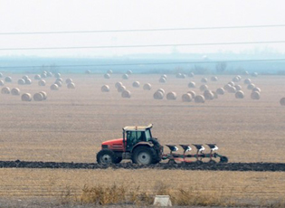 Belgrade – The Agricultural Land Administration developed a new GIS application that provides an overview of agricultural land. A web application for data on state-owned agricultural land has been publicly available as of July 15. The application is based on the data obtained from the annual programs of protection, arrangement and use of agricultural land, which from this year onward all local self-governmental units produce through the Administration’s information system through using the application for the annual program.
The data on agricultural land is presented at different levels: plots in public tenders, plots in multi-annual contracts, plots in contracts that expire in the current year, unrealized public tenders, plots excluded from the program and plots in co-ownership. The data presented refer to the annual program for 2018/2019, except for the following municipalities and cities: Čačak, Čajetina, Ćićevac, Crna Trava, Doljevac, Jagodina, Koceljeva, Kraljevo, Kruševac, Lebane, Medvedja, Prijepolje, Rekovac, Užice, Varvarin, Vladičin Han, Žitoradja and Vršac.
The program for 2019/2020 is presented for the above-mentioned municipalities and cities.
Due to technical reasons, it was not possible to display data for Coka, Kovačica, nor for the city municipalities of Petrovaradin, Vranjska Spa, Niš-Medijana, Niš-Pantelej, Niš-Niška Spa and Niš-Palilula.
Source: E-kapija and Coordination Body